GRSG Python Course Review
GRSG Committee Member, Jennifer Scoular attended GRSG’s recent Python Training Course and shares her thoughts on what she learnt.
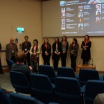
“On 4th June, the GRSG held their first Geospatial Python for Beginners one-day course lead by Andrew Cutts (AC Geospatial) at the Geological Society in London. The course was limited to just 10 people to provide the best learning environment and attendees were a mix from academia and industry.
The day began with a discussion on the different Python IDE’s and the pros and cons of each for our own programming needs. The course was taught in Jupyter Notebooks as that is one of the easiest to use IDE’s and best for presentation and education purposes.
The morning consisted of a fast-paced introduction to Python basics, such as the data types (lists, tuples, strings, floats etc), programming basics including loops, if/else statements, operators and reading and writing text files. Andy taught as a mixture of examples and short coding challenges for the attendees.
After a much-appreciated provided lunch, we moved onto topics more specifically relevant to the geospatial industry, including creating shapefiles, reading a raster dataset in GDAL and using some of the GDAL functions. While it’s impossible to cover everything in a day, the course certainly opened everyone’s eyes to how Python can be used within their work and useful resources to keep learning.
The feedback from the course has been overwhelmingly positive and the resources provided by Andy are invaluable for those starting out on their programming journey! The GRSG hopes to continue with this Python series later in the year.”


