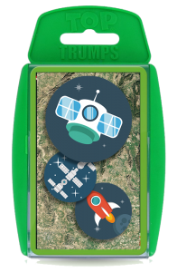
Regional Public Lecture: Satellite Top Trumps : The Geological Edition
 Venue: Queen’s University Belfast
Date: 16 October 2018
18.00 Lecture begins
18.45 Questions and answers
19.00 Drinks Reception
20.00 Close
Presenter: GRSG Chairman, Charlotte Bishop
A regional lecture in the Geological Society’s Public Lecture series.
Satellites have taken images of the earth for over 40 years some designed for specific applications but nothing has been designed with the end user in mind. This whistle stop tour presentation will take us back to 1972 with the launch of Earth Resources Terrain Satellite (ERTS-1) which then became known as the Landsat-1 and was the start of the Landsat series (now on its 8th satellite) and I would argue also the start of the commercial usage of Earth Observation data, right up to the present day and beyond as we look at what is upcoming and benefits to geology.
This talk will take us through the challenges and opportunities within the space sector that have led to some fantastic missions both from a technological and operational point of view whilst also touching on how open data has made such a massive impact on our capabilities specifically for geology.
Hardware has often been more technologically driven rather than user driven given that a large number of what we might consider ‘geological missions’ have been governmentally funded however it doesn’t mean that commercial missions are not capable of providing useful geological information to support the wealth of challenges faced across oil & gas, mining and engineering sectors the new paradigm here is managing the expectation and associated value proposition such technology provides.
As we move to the current and future era, what’s next and how does this impact geology? Space is changing and the applications are not changing but evolving, leaving more opportunities to build on the legacy that early EO has provided to provide some real value to geological industries both upstream in exploration and logistics as well as downstream in monitoring and remediation. Satellites are not just a one time usage but a multi-purpose toolkit that provide the contextual information not provided by other sources that might have to be procured such as seismic. Their value is in understanding the potential and the information they provide rather than the technology that drives them.
What can these satellites do for you? They provide information to support exploration, context for monitoring and de-risking and above all else are cost efficient to deploy from the safety of your desktop. No technology has the complete answer but satellites provide a big piece of that picture.


